GroundTruther
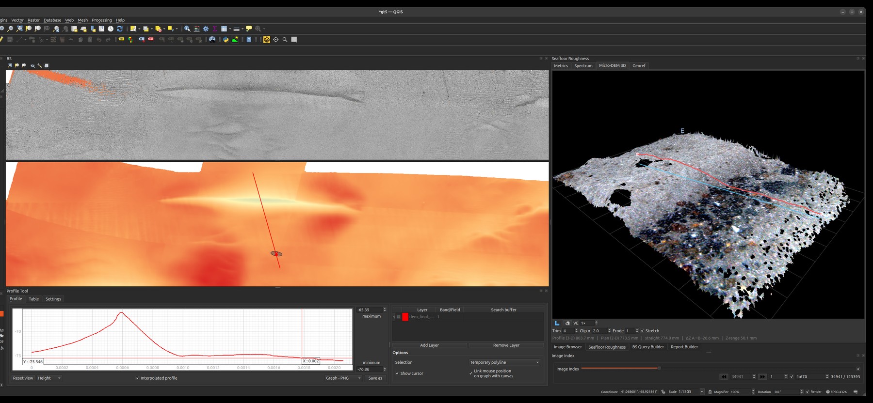
A QGIS plugin for seafloor characterization — explore and analyse multibeam echo-sounder (MBES) bathymetry and backscatter together with georeferenced seafloor imagery and survey video, inside a single, map-centric workspace.
The seafloor is observed through very different instruments — acoustics paint broad, continuous coverage; cameras give sparse but unambiguous ground truth. GroundTruther brings them onto the same canvas so you can move fluidly between "what does the acoustic signal say here?" and "what does the seabed actually look like here?" — and build defensible, reproducible interpretations that link morphology, backscatter, and observed biota.
What you can do
- Browse thousands of geotagged seafloor images spatially — click the map to jump to the nearest image, or scrub an index and watch the map follow.
- Play survey video geo-linked to the map, with the canvas panning to the current frame's GPS position.
- Annotate images and video frames with labelled bounding boxes and confidence scores.
- Query MBES products acoustically — pull backscatter / bathymetric-derivative values under points or sampling shapes via a remote GRASS GIS service.
- Reconstruct the seabed in 3-D from stereo imagery — a real-height micro-DEM of the patch under the camera, viewable as a photo-textured mesh and exportable as a georeferenced GeoTIFF.
- Measure seafloor roughness from the imagery itself — per-frame spectral roughness (γ₂) and its relief power spectrum, validated against independent substrate labels, computed from the HabCam stereo pairs.
- Composite frames into georeferenced photo mosaics, and — via a companion script — into an along-track seabed ribbon spanning millimetres to ~170 m.
- View the acoustic surface in 3-D with pick-and-measure read-out over either the selected soundings or a reference bathymetry raster.
- Run any GRASS module on demand — the toolbox builds a dialog from the module's own interface description and returns results straight to QGIS.
- Generate quantitative reports that tie the acoustic and optical evidence together.
Why it exists
GroundTruther provides an efficient means of understanding the relationships between morphology, backscatter, and the observed biota — and thus between the physical and ecological elements of the seafloor. It offers new ways to interpret remotely sensed MBES information, supports the development of spatial distribution models, and helps improve the ground-truth databases used to build geophysical models that connect acoustic backscatter to the seabed's natural properties.
Cite the paper
GroundTruther is described in a peer-reviewed article in Environmental Modelling & Software. If you use it in your research, please cite:
Di Stefano, M. GroundTruther: A QGIS plugin for seafloor characterization. Environmental Modelling & Software. https://www.sciencedirect.com/science/article/pii/S1364815223002475
Get started
Head to Installation to set up QGIS and the plugin, point it at your data via Configuration, then explore the Tools. A free sample dataset (CC-BY-4.0) lets you try everything end-to-end.
Bringing your own survey? The Data model section documents every column GroundTruther reads.
At a glance
| Host | QGIS 4 / Qt6 (Linux, macOS, Windows) |
| Inputs | MBES soundings (Parquet), bathymetry rasters, HabCam imagery + metadata, survey video + GPS log, detector annotations |
| Acoustic/GRASS backend | FastGIS GRASS API (api.fastgis.eu) |
| Stereo backend | GPU stereo-roughness service, reached through FastGIS or directly |
| Configuration | One YAML file per install — 27 settings |
| Sample data | Zenodo 7995674 (CC-BY-4.0) |
| License | GPL-3.0-or-later |